

Survey
-
 Quickview
£180.00
Quickview
£180.00Stow, John (1525-1605)/ Strype, John (1643–1737): The Prospect of Lincoln’s Inn. W.Innys and J.Richardson [et al] London 1754-55 copper engraved print; overall 25 x 41 cm, plate 21 x 34 cm. some foxing, staining and off-set; paper imperfections; some small paperloss in left margin; o/w vg cond. First published in […]
-
 Quickview
£350.00
Quickview
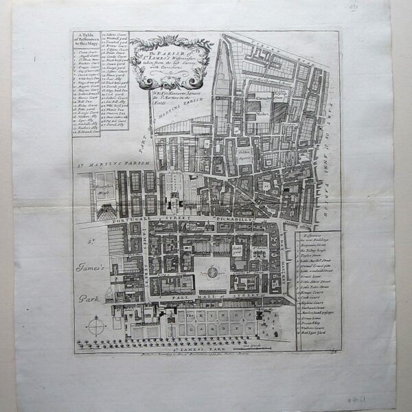
£350.00Stow, John (1525-1605)/ Strype, John (1643–1737): The Parish of St. James’… W.Innys and J.Richardson [et al] London 1754-55 copper engraved map; overall 42 x 45 cm, plate 30 x 36 cm. folds as issued; some foxing, staining and off-set; paper imperfections; printer’s creases; centrefold discoloured; small marginal hole not affecting […]
-
 Out of Stock
Quickview
Out of Stock
Quickview
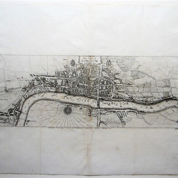
Stow, John (1525-1605)/ Strype, John (1643–1737): The City of London as in Q. Elizabeth’s Time. W.Innys and J.Richardson [et al] London 1756 copper engraved map; overall 42 x 54 cm, plate 18 x 47 cm. folds as issued; some foxing, staining and off-set; some discolouration in centrefold ; paper imperfections […]
-
 Quickview
£90.00
Quickview
£90.00Stow, John (1525-1605)/ Strype, John (1643–1737): Portsoken Ward… W.Innys and J.Richardson [et al] London 1754-55 copper engraved map; overall 42 x 25 cm; plate 31 x 18 cm. some foxing, staining and off-set; 1 repaired marginal tear; printer’s creases; o/w vg cond. First published in 1720, Strype’s re-issue appears as […]
-
 Quickview
£90.00
Quickview
£90.00Stow, John (1525-1605)/ Strype, John (1643–1737): Queen Hith Ward and Vintry Ward…. W.Innys and J.Richardson [et al] London 1754-55 copper engraved map; overall 42 x 25 cm; plate 31 x 18 cm. some foxing, staining and off-set; o/w vg cond. First published in 1720, Strype’s re-issue appears as a much […]
-
 Quickview
£90.00
Quickview
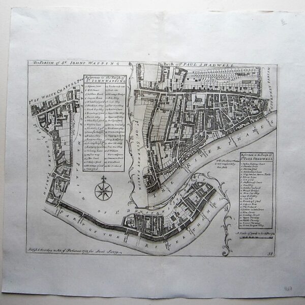
£90.00Stow, John (1525-1605)/ Strype, John (1643–1737): The Parish of St. Johns Wapping/ The Parish of St. Paul Shadwell. W.Innys and J.Richardson [et al] London 1754-55 copper engraved map; overall 42 x 45 cm, plate 30 x 36 cm. folds as issued; some foxing, staining and off-set; some slight discolouration in […]
-
 Quickview
£125.00
Quickview
£125.00Stow, John (1525-1605)/ Strype, John (1643–1737): Shoreditch, Norton Folgate and Crepplegate without…. W.Innys and J.Richardson [et al] London 1754-55 copper engraved map; overall 42 x 45 cm, plate 30 x 36 cm. folds as issued; some foxing, staining and off-set; some discolouration in centrefold ; paper imperfections ; o/w vg […]
-
 Quickview
£180.00
Quickview
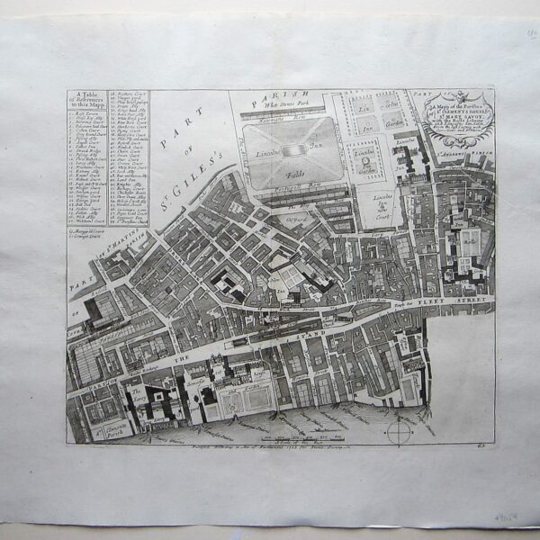
£180.00Stow, John (1525-1605)/ Strype, John (1643–1737): A Mapp of the Parishes of St. Clements Danes, St. Mary Savoy; … W.Innys and J.Richardson [et al] London 1754-55 copper engraved map; overall 42 x 45 cm, plate 30 x 36 cm. folds as issued; some foxing, staining and off-set; paper imperfections; printer’s […]
-
 Quickview
£90.00
Quickview
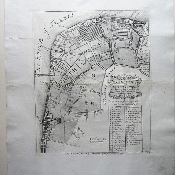
£90.00Stow, John (1525-1605)/ Strype, John (1643–1737): Lambeth and Christ Church Parish, Southwark… W.Innys and J.Richardson [et al] London 1754-55 copper engraved map; overall 42 x 45 cm, plate 30 x 36 cm. folds as issued; some foxing, staining and off-set; some discolouration in centrefold; paper imperfections; plate slightly rubbed in […]
-
 Quickview
£250.00
Quickview
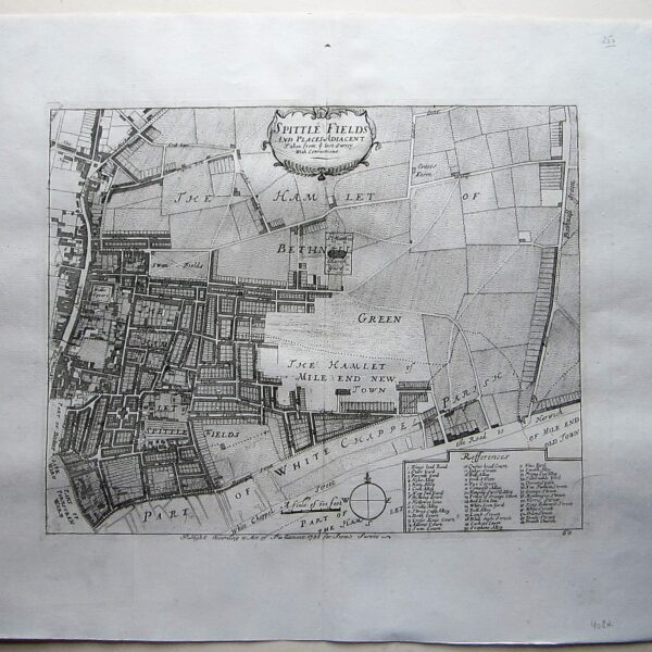
£250.00Stow, John (1525-1605)/ Strype, John (1643–1737): Spittle Fields and Places Adiacent… W.Innys and J.Richardson [et al] London 1754-55 copper engraved map; overall 42 x 45 cm, plate 30 x 36 cm. folds as issued; some foxing, staining and off-set; some discolouration in centrefold ; paper imperfections; stitch hole in top […]
-
 Quickview
£180.00
Quickview
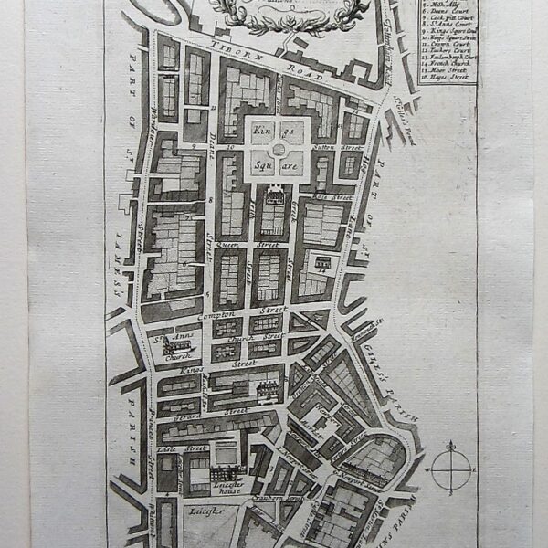
£180.00Stow, John (1525-1605)/ Strype, John (1643–1737): A Mapp of St. Anns… W.Innys and J.Richardson [et al] London 1754-55 copper engraved map; overall 42 x 25 cm; plate 31 x 18 cm. some foxing, staining and off-set; printer’s creases; o/w vg cond. First published in 1720, Strype’s re-issue appears as a […]
-
 Quickview
£180.00
Quickview
£180.00Stow, John (1525-1605)/ Strype, John (1643–1737): St. Bartholomew’s Hopsitall in Smithfield. W.Innys and J.Richardson [et al] London 1754-55 copper engraved print; overall 25 x 41 cm, plate 21 x 34 cm. some foxing, staining and off-set; paper imperfections; o/w vg cond. First published in 1720, Strype’s re-issue appears as a […]
-
 Quickview
£250.00
Quickview
£250.00Stow, John (1525-1605)/ Strype, John (1643–1737): A Mapp of the Parish of St. Giles…. W.Innys and J.Richardson [et al] London 1754-55 copper engraved map; overall 42 x 45 cm, plate 30 x 37 cm. folds as issued; some foxing, staining and off-set; some short marginal tears; paper imperfections; o/w vg […]
-
 Quickview
£350.00
Quickview
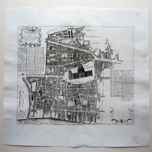
£350.00Stow, John (1525-1605)/ Strype, John (1643–1737) The Wards of Farrington within and Baynards Castle… W.Innys and J.Richardson [et al] London 1754-55 copper engraved map; overall 42 x 45 cm, plate 30 x 36 cm. folds as issued; some foxing, staining and off-set; some discolouration in centrefold ; paper imperfections ; […]
-
 Quickview
£90.00
Quickview
£90.00Stow, John (1525-1605)/ Strype, John (1643–1737): St. Pauls Parish Shadwell… W.Innys and J.Richardson [et al] London 1754-55 copper engraved map; overall 42 x 25 cm; plate 31 x 18 cm. some foxing, staining and off-set; hole in lower margin; o/w vg cond. First published in 1720, Strype’s re-issue appears as […]
-
 Quickview
£250.00
Quickview
£250.00Stow, John (1525-1605)/ Strype, John (1643–1737): The Tower and St. Catherine’s.. W.Innys and J.Richardson [et al] London 1754-55 copper engraved map; overall 42 x 45 cm, plate 30 x 36 cm. folds as issued; some foxing, staining and off-set; some discolouration in centrefold ; paper imperfections ; o/w vg cond. […]