

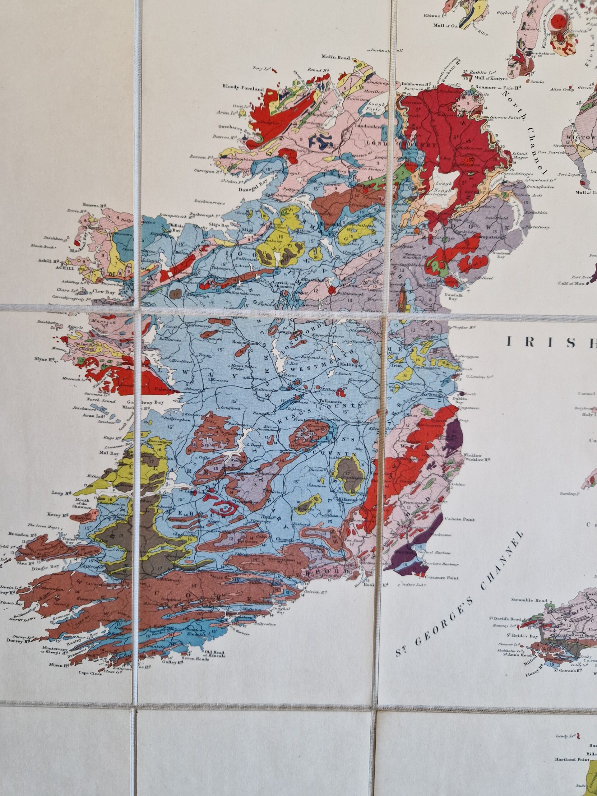
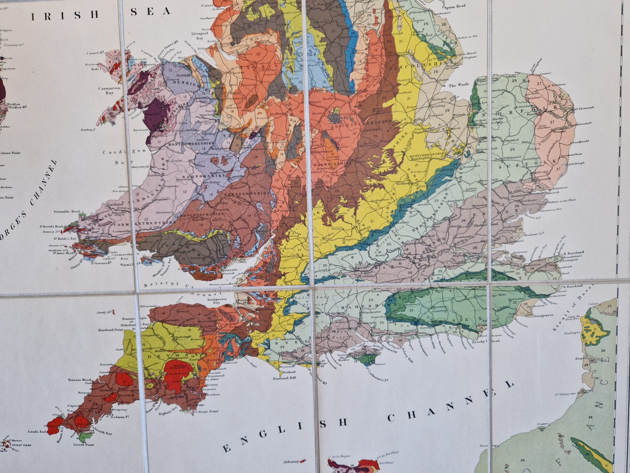
Teall,Sir Jethro Justinian Harris (1849 – 1924) Geological Map of the British Islands, based on the work of the Geological Survey
Ordnance Survey Office Southampton 1924




British Isles – Geological map – Folding map – Vintage
£350.00
Description
Teall,Sir Jethro Justinian Harris (1849 – 1924) Geological Map of the British Islands, based on the work of the Geological Survey
Ordnance Survey Office Southampton 1924
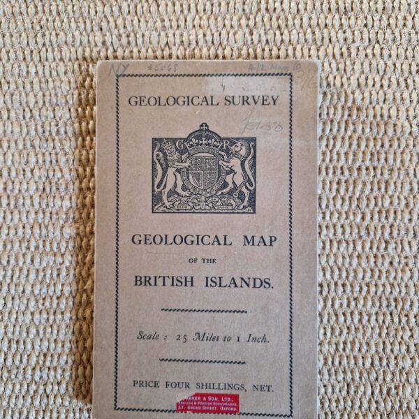
colour printed folding map; overall 89 x 66 cm, folds down to 18 x 11 cm. paste don cloth, 30 segments; exc. cond. printed paper cover, front with pasted label; o/w exc. cond.
A very decorative geological map of the British Isles by Teall. Despite the date in the title (2nd edition, 1912), the map is dated at the bottom left corner ‘1924’. On the top right hand side, the various deposits and geological layers are explained in the Index.
Teall was born in Sandwich, Kent and studied geology and petrography, the science concerned with the composition and properties of rocks. In 1890, he was elected a Fellow of the Royal Society. Between 1900-1902, he was President of the Geological Society of London. In 1901, he became the Director of His Majesty’s Geological Survey, personally completing much work in north west Scotland. He was knighted in 1916 for his contribution to the survey.
[ref: 5068] £350Related products
-
 Quickview
-

 Quickview
-
 Quickview
-

 Quickview
£30.00
Quickview
£30.00Geographia Rambler’s Guide to Dorking and the Surrounding District – A foothpath guide with maps by A Son Of Surrey. (Fourth revised edition)
Reviews
There are no reviews yet.