



Description
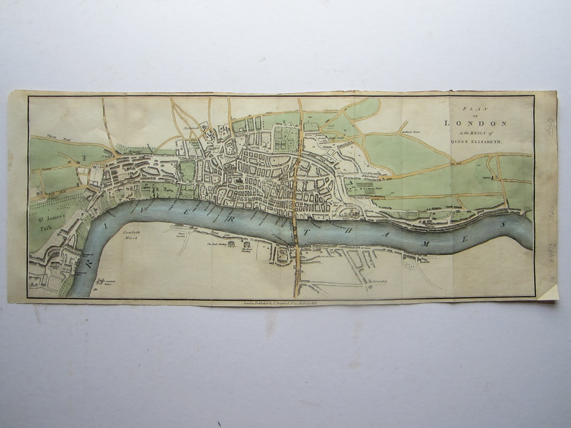
anon Plan of London in the Reign of Queen Elizabeth.
Stratford, James London 1720
copper engraved map with original colouring; image 19 x 50 cm; folds as issued; some staining and wear and tear; edges slightly frayed; o/w g cond.
A very charming plan of London at the time of Elizabeth I, from Clerkenwell to Southwark, and St. James’ Park to Wapping. The map shows the Tower of London, the pre-1666 St.Paul’s Cathedral, Tyborn Road leading up to what is now known as Marble Arch but was the place for executions, Piccadilly and Pall Mall ( Pell Mell – a reference to a popluar lawn game, similar to croquet), and South of the river bull and bear fighting rings, near the present day Globe theatre.
[ref: 4913] £250




Reviews
There are no reviews yet.